The LANDSLIP programme (full title below) was an innovative research initiative involving multiple partners. It helped forge a better understanding of where, when, and why landslides happen so that people can build resilience to them. By avoiding risks and developing early warning systems, we can ensure that the right action can be taken in time to save lives.
Project overview
Full title: Landslide multi-hazard risk assessment, preparedness and early warning in South Asia: Integrating meteorology, landscape and society (LANDSLIP)
Dates: 2016 – 2020
Location: Nilgiris and Darjeeling Districts in southern and north-eastern India
Our role: Practical Action contributed to this multi-disciplinary research partnership with scientific expertise and practical knowledge from decades of developing community-centred early warning systems. Practical Action led on stakeholder engagement, communication, sustainability, knowledge and legacy.
Partners: King’s College London, British Geological Survey, UK Met Office, Geological Survey of India, Amrita University, Consiglio Nazionale delle Ricerche, Newcastle University, Keystone Foundation, and Save The Hills.
Project Budget: £125,000
Aim: Resilience that protects
Funded by: Natural Environment Research Council (NERC) and the Foreign, Commonwealth and Development Office (FCDO) as part of the SHEAR Programme.
Through advances in interdisciplinary science and application in practice with national and district authorities, the LANDSLIP consortium has contributed to the better understanding of risk, forecasting and preparedness for rainfall-induced landslides in India.
– Dr Anshu Ogra, King’s College London
Context
In India, landslides are a major hazard. More than 12% of this huge country is affected. People die and homes and businesses are damaged and destroyed. The main triggers of landslides are extreme rainfall and earthquakes.
A key problem is the difficulty in predicting when and where a landslide will occur, how severe it will be, what path the debris will take, and what damage it’s likely to cause. A lack of data from previous landslides makes it difficult to learn from the past to build resilience for the future.
Another challenge is how to translate the scientific data that exists into forecasts that can feed into early warning systems – vital for enabling people to take the right action in time to save lives.
Our approach
Given that heavy rainfall is one of the main triggers of landslides, the LANDSLIP project has built on advances in rainfall forecasting to better understand how patterns and levels of rainfall link to previous landslide events.
With an in-depth understanding of the details of past landslide events, we are able to develop models and tools that enable an understanding of the conditions under which landslides happen, and the likelihood is of them reoccurring under similar circumstances. Improvements in rainfall-induced landslide forecasting creates an opportunity to build community resilience and reduce risks.
LANDSLIP worked in collaboration with partners based in India, including authorities at national, state and district-level and local NGOs. The interdisciplinary project team included experts on landslide processes, meteorological forecasting, social sciences, data sciences and engagement with practitioners.
Based on Practical Action’s decades of experience in developing community-centred early warning systems for flooding, we contributed to this research partnership with both scientific expertise and knowledge. This is grounded in our close relationships with civil society and government officials responsible for preparing for, or responding to, disasters and has helped to bridge the gap between science and practice.
Our goals
The aim of LANDSLIP was to build a better understanding of landslide risks and work towards forecasting mechanisms that support early warning systems, as well as helping decision-makers and community members prepare for and take action before a landslide happens.
- LANDSLIP developed tools and methodologies to support the collection of data for improved landslide forecasting.
- Weather patterns associated with landslides were identified and used to forecast landslide occurrence across a broad region up to two weeks in advance.
- A prototype online platform that combines data from hazard modelling and other information to better support decision-makers.
- A prototype regional landslide forecast bulletin was co-developed and produced daily throughout the Indian monsoon seasons in 2020 and 2021 for both pilot locations.
- Institutional mapping and stakeholder engagement activities provided key insights into the landscape in which a potential landslide early warning system could operate, identifying key stakeholder roles and responsibilities.
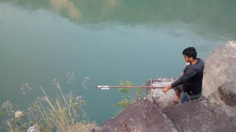
- The project also trialled several cutting-edge science and technology innovations, including crowdsourcing of landslide data.
-
Project impact
Achievements:
An interdisciplinary team working across multiple countries and sectors came together to collectively develop a prototype regional landslide-forecasting system for district authorities in India.
This was trialled in two regions of India, the Nilgiris and Darjeeling. Daily forecast bulletins were co-developed to create a method of sharing and communicating risk knowledge and landslide forecasts in a way that will help government officials to take the action needed to protect people from disasters.
However, the impacts of the project go beyond the development of this prototype landslide forecasting system. We focused heavily on knowledge exchange and capacity building activities, particularly with the Geological Survey of India, who are applying this learning as they establish a National Landslide Forecasting Centre.
Learning and knowledge from the project has also been captured and shared with key stakeholders in India, South Asia, and globally, providing vital resources to support the development of early warning systems for landslides in similarly at-risk areas.
Sustainable Development Goals
This project contributes to progress towards at least three of the seventeen SDGs.


Work like this depends on your support
Help us work with communities to tackle some of the world’s toughest problems
Project Partnership and Funding:


